Climate change
Copernicus: A summer of wildfires saw devastation and record emissions around the Northern Hemisphere
The Copernicus Atmosphere Monitoring Service has been closely monitoring a summer of extreme wildfires across the Northern Hemisphere, including intense hotspots around the Mediterranean basin and in North America and Siberia. The intense fires led to new records in the CAMS dataset with the months of July and August seeing their highest global carbon emissions respectively.
Scientists from the Copernicus Atmosphere Monitoring Service (CAMS) have been closely monitoring a summer of severe wildfires which have impacted many different countries across the Northern Hemisphere and caused record carbon emissions in July and August. CAMS, which is implemented by the European Centre for Medium-Range Weather Forecasts on behalf of the European Commission with funding from the EU, reports that not only large parts of the Northern Hemisphere were affected during this year’s boreal fire season, but the number of fires, their persistence and intensity were remarkable.
As the boreal fire season draws to a close, CAMS scientists reveal that:
- Dry conditions and heatwaves in the Mediterranean contributed to a wildfire hotspot with many intense and fast developing fires across the region, which created large amounts of smoke pollution.
- July was a record month globally in the GFAS dataset with 1258.8 megatonnes of CO2 released. More than half of the carbon dioxide was attributed to fires in North America and Siberia.
- According to GFAS data, August was a record month for fires as well, releasing an estimated 1384.6 megatonnes of CO2 globally into the atmosphere.
- Arctic wildfires released 66 megatonnes of CO2 between June and August 2021.
- Estimated CO2 emissions from wildfires in Russia as a whole from June to August amounted to 970 megatonnes, with the Sakha Republic and Chukotka accounting for 806 megatonnes.
Scientists at CAMS use satellite observations of active fires in near-real-time to estimate emissions and predict the impact of resulting air pollution. These observations provide a measure of the heat output of fires known as fire radiative power (FRP), which is related to the emission. CAMS estimates daily global fire emissions with its Global Fire Assimilation System (GFAS) using the FRP observations from the NASA MODIS satellite instruments. The estimated emissions of different atmospheric pollutants are used as a surface boundary condition in the CAMS forecast system, based on the ECMWF weather forecast system, which models the transport and chemistry of atmospheric pollutants, to predict how global air quality will be affected up to five days ahead.
The boreal fire season typically lasts from May to October with peak activity taking place between July and August. In this summer of wildfires, the most affected regions were:
Mediterranean
Many nations in eastern and central Mediterranean suffered the effects of intense wildfires throughout July and August with smoke plumes clearly visible in satellite imagery and CAMS analyses and forecasts crossing the eastern Mediterranean basin. As southeast Europe experienced prolonged heatwave conditions, CAMS data showed daily fire intensity for Turkey reaching the highest levels in the GFAS dataset dating back to 2003. Following the fires in Turkey, other countries in the region went on to be affected by devastating wildfires including Greece, Italy, Albania, North Macedonia, Algeria, and Tunisia.
Fires also hit the Iberian Peninsula in August, affecting vast parts of Spain and Portugal, especially a large area near Navalacruz in the Avila province, just west of Madrid. Extensive wildfires were also registered east of Algiers in northern Algeria, CAMS GFAS forecasts showing high surface concentrations of the polluting fine particulate matter PM2.5.
Siberia
While the Sakha Republic in northeastern Siberia typically experiences some degree of wildfire activity every summer, 2021 has been unusual, not just in size but also the persistence of high-intensity blazes since the beginning of June. A new emissions record was set on 3rd August for the region and emissions were also more than double the previous June to August total. In addition, the daily intensity of the fires reached above average levels since June and only began to subside in early September. Other areas affected in Siberia have been the Chukotka Autonomous Oblast (including parts of the Arctic Circle) and the Irkutsk Oblast. The increased activity observed by CAMS scientists corresponds with increased temperatures and decreased soil moisture in the region.
North America
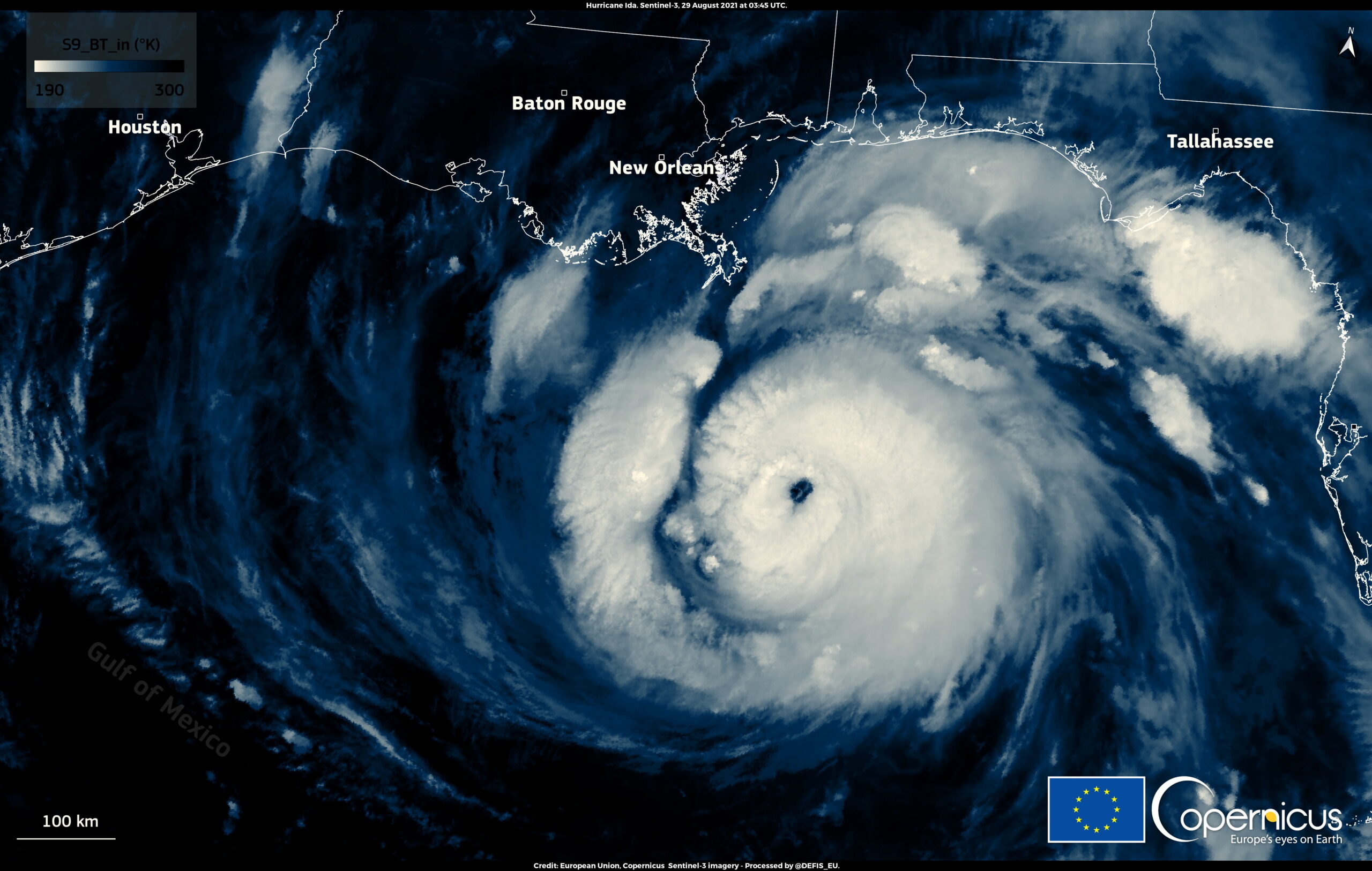
Large scale wildfires have been burning in western regions of North America throughout July and August affecting several Canadian provinces as well as the Pacific Northwest and California. The so-called Dixie Fire which raged across northern California is now one of the biggest ever recorded in the state’s history. Resulting pollution from the persistent and intense fire activity affected the air quality for thousands of people in the region. CAMS global forecasts also showed a mixture of smoke from the long-running wildfires burning in Siberia and North America travelling across the Atlantic. A clear plume of smoke was seen moving across the north Atlantic and reaching western parts of the British Isles in late August before crossing the rest of Europe. This happened as Saharan dust was travelling in the opposite direction across the Atlantic including a section over southerly areas of the Mediterranean resulting in reduced air quality.
Mark Parrington, Senior Scientist and wildfire expert at the ECMWF Copernicus Atmosphere Monitoring Service, said: “Throughout the summer we have been monitoring wildfire activity across the Northern Hemisphere. What stood out as unusual were the number of fires, the size of the areas in which they were burning, their intensity and also their persistence. For example, the wildfires in Sakha Republic in northeastern Siberia have been burning since June and only started receding in late August although we have been observing some continuing fires in early September. It’s a similar story in North America, parts of Canada, the Pacific Northwest and California, which have been experiencing large wildfires since the end of June and beginning of July and are still ongoing.”
“It is concerning that drier and hotter regional conditions - brought about by global warming - increase the flammability and fire risk of vegetation. This has led to very intense and fast-developing fires. While the local weather conditions play a role in the actual fire behaviour, climate change is helping provide the ideal environments for wildfires. More fires around the world are anticipated in the coming weeks, too, as the fire season in the Amazon and South America continues to develop,” he added.
More information on wildfires in the Northern Hemisphere during summer 2021.
The CAMS Global Fire Monitoring page can be accessed here.
Find out more about fire monitoring in the CAMS Wildfire Q&As.
Copernicus is a component of the European Union’s space programme, with funding by the EU, and is its flagship Earth observation programme, which operates through six thematic services: Atmosphere, Marine, Land, Climate Change, Security and Emergency. It delivers freely accessible operational data and services providing users with reliable and up-to-date information related to our planet and its environment. The programme is coordinated and managed by the European Commission and implemented in partnership with the Member States, the European Space Agency (ESA), the European Organisation for the Exploitation of Meteorological Satellites (EUMETSAT), the European Centre for Medium-Range Weather Forecasts (ECMWF), EU Agencies and Mercator Océan, amongst others.
ECMWF operates two services from the EU’s Copernicus Earth observation programme: the Copernicus Atmosphere Monitoring Service (CAMS) and the Copernicus Climate Change Service (C3S). They also contribute to the Copernicus Emergency Management Service (CEMS), which is implemented by the EU Joint Research Council (JRC). The European Centre for Medium-Range Weather Forecasts (ECMWF) is an independent intergovernmental organisation supported by 34 states. It is both a research institute and a 24/7 operational service, producing and disseminating numerical weather predictions to its member states. This data is fully available to the national meteorological services in the member states. The supercomputer facility (and associated data archive) at ECMWF is one of the largest of its type in Europe and member states can use 25% of its capacity for their own purposes.
The Copernicus Atmosphere Monitoring Service website.
The Copernicus Climate Change Service website.
More information on Copernicus.
Twitter:
@CopernicusECMWF
@CopernicusEU
@ECMWF
Share this article:
EU Reporter publishes articles from a variety of outside sources which express a wide range of viewpoints. The positions taken in these articles are not necessarily those of EU Reporter. Please see EU Reporter’s full Terms and Conditions of publication for more information EU Reporter embraces artificial intelligence as a tool to enhance journalistic quality, efficiency, and accessibility, while maintaining strict human editorial oversight, ethical standards, and transparency in all AI-assisted content. Please see EU Reporter’s full A.I. Policy for more information.


The South Caucasus at a historic turning point: Between lasting peace and renewed confrontation
The security environment of the South Caucasus amid changing geopolitical realities

Commission registers two European Citizens' Initiatives on education and housing

Commission sends Statements of Objections to several companies and trade associations in suspected construction chemicals cartel

Why the US is losing its legitimacy as a global superpower and the trust of the comity of nations

Commission endorses Latvia’s €617 million Social Climate Plan to support vulnerable households and transport users in the clean transition

Commission outlines measures to strengthen Europe's banking sector and support growth

As Ireland chairs the EU Presidency, what impact has over fifty years of EU membership had on Ireland

JoinCare explores scientific exchange during visit to Japan’s National Institute of Infectious Diseases

New episode – DGT podcast: Languages and Technology

Become a European Commission trainee – applications are now open

Commission outlines measures to strengthen Europe's banking sector and support growth

British political shifts and the future of UK-China ties
The South Caucasus at a historic turning point: Between lasting peace and renewed confrontation
As Ireland chairs the EU Presidency, what impact has over fifty years of EU membership had on Ireland

The Digital Markets Act Is Hurting Europeans. It’s Time to Put Progress, Free Markets, and Competition First

Kazakhstan reforms under scrutiny at Brussels Press Club round table

Japan should face up to history and contribute more to regional peace

Ambassador calls for 'speeding up' of co-operation between EU and Kazakhstan

Timur Turlov at Smart Moves Summit 2025: How chess can transform global education

Shevtsova’s case: Out-of-court sanctions dismantling trust in Ukrainian cause
The future of European transport

Trump Vs Trueman

US 'no longer' an 'unconditional ally' for Europe - MEP
-
 South Caucasus1 day ago
The South Caucasus at a historic turning point: Between lasting peace and renewed confrontation
-
South Caucasus2 days ago
The security environment of the South Caucasus amid changing geopolitical realities
-
 European Citizens' Initiative4 days ago
Commission registers two European Citizens' Initiatives on education and housing
-
 European Commission2 days ago
Commission sends Statements of Objections to several companies and trade associations in suspected construction chemicals cartel